Using openlayer in work currently and need to write down some notes about it.
EPSG 4326 VS EPSG 3857
地理Coordiante系统由EPSG编号标识。最常用于网络地图应用的两个坐标系统是EPSG:4326和EPSG:3857。
- EPSG:4326(又名WGS84,未投影)是一个地理的非项目坐标系。它是lat,longs GPS显示器,单位是十进制度。EPSG:4326无法在平面地图上以有意义的方式显示。
- EPSG:3857(又名Pseudo-Mercator,球形墨卡托或Web墨卡托)是投影坐标系。这是Google Maps和几乎所有其他Web制图应用程序使用的坐标系。
通常,数据存储在EPSG:4326中并显示在EPSG:3857中,自行转换。
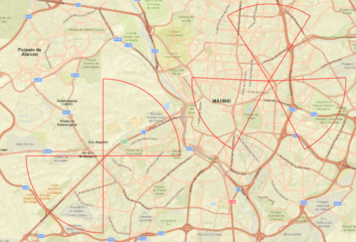
Function to draw a sector accurately
Cuz the untransformed sector displayed with great error in angle = 45° (start angle) so I have to turn to this Function as following, which convert longitude and latitude into Mercator projection first before the calculation.
1 | function GetMarcoXyArcArray(origin,radius,sides,r,angel) { |
Thanks to tianshibufan521’s post
After modification:
190813 update
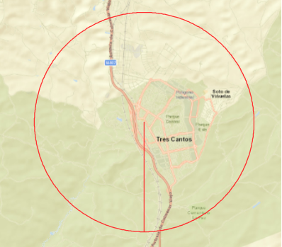
this method will lead to wrong presentation size at about 4/5 of expected radius due to the Mercator projection. I couldn’t figure out why for the second time I tried the origin calculation method as following, it turned out to appear normally with start angle of 45°.
1 | for (var i = 0; i < sides; ++i) { |
calculate longitude & latitude via coordinate
former dev using func getJWD to calculate the coordinates, but this func cause the display error with start degree of 45°, so I discarded it.
For more info about this func : link
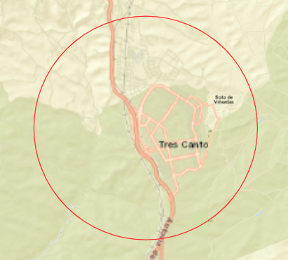
Draw a circle
Simply used ol.geom.Circle instead of ol..geom.Polygon, which will cause a start/end radius as follows:
 |
 |
1 | var circle = new ol.geom.Circle( |
OpenLayer Samples link || Circle
update:
The pattern turned out to be simple circle pattern,which does not include geometry params,but our project need geometry params in GeoJSON format to decide which area is covered.
So I finally turn to ol/geom/Polygon.fromCircle which transform plain circle into Polygon format. It returns Polygon geometry so that can be used in further calculation of coverage.
1 | var circle = new OpenLayers.geom.Circle(circleParams.center, circleParams.radius); |